 Hancock, 1798.Hancock, 1798.
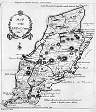
A Map of the Isle of Man
size: 205mm x 180mm 1:204,000
Map to accompany Feltham's Tour - published in Bath and engraver was R. Hancock (Imprint Ae(os) "R Hancock Sc Bath" - Tooley mentions R Hancock , Engraver of Plan of Bath (1793) and Worcester (? 1780).
Based on Fannin (eg notes on Anchorages) but with some details from Quayle, 1794 and possibly Cary 1794 who also used the hachured circles to represent hills..
EMIoM p43
Feltham Tour Bath 1798.
|
|
||
|
|
||
|
|
||
|
Any comments, errors or omissions gratefully received
The Editor |
||